Atlantic Avenue - Barclays Center

By popular demand, I have started to document the Atlantic Avenue - Barclays Center station. This station is no joke! This is my second trip, and we will keep counting...

Curved stair case following the shape of the corner building on Hanson Pl x Flatbush

Curved stair case following the shape of the corner building on Hanson Pl x Flatbush

Parallel to 2 / 3 / 4 / 5 platforms, connections to LIRR

Parallel to 2 / 3 / 4 / 5 platforms, connections to LIRR

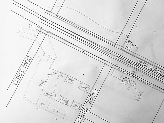
Second draft (pencil x hand) on first draft (computer x cad)

Second draft (pencil x hand) on first draft (computer x cad)

BEHIND THE SCENES - CREATING THE X-RAY SERIES

Last week was an exciting week for Project Subway! I released my new x-ray series and was thrilled to get some generally positive feedback. Thank you all for your love and support! Check out the coverage by CityLab and Gothamist if you haven't already :)

Since a few people have asked, I would like to share with you a little bit about my process. For the first part where I survey and sketch the stations, you can read about it here

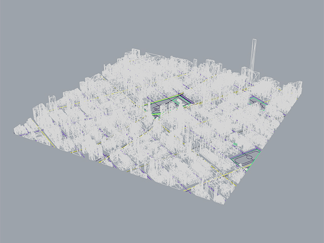
For the new series, I first download a 3D model of the city from cadmapper. Let me use the Union Square drawing as an example:

3D model from cadmapper.com (you can download up to 1 square km for free)

3D model from cadmapper.com (you can download up to 1 square km for free)

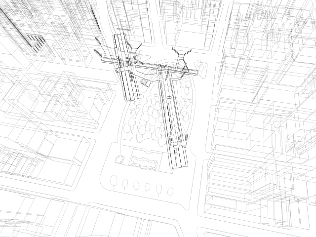
Then I find an angle that could work:

And I import the station model I made from before:

Then I go to Google Maps and get a general feel of the area, including trees, the configuration of the park, and the buildings:

Then I do some research on specific landmarks and transfer that detail into my drawing, for example, this clock thing (it's called the metronome) that always keeps people wondering:

metronome (source: wikipedia)

metronome (source: wikipedia)

Then I export the lines into illustrator and edit the line weights:

x ray process 08.jpg

Then I layer texture, streets, platform colors, people, and street names:

Textured underlay

Textured underlay

Translucent white indication of streets

Translucent white indication of streets

Colored platforms according to train lines

Colored platforms according to train lines

Added little people for scale

Added little people for scale

And finally street names and business names

And finally street names and business names

And that was it! I repeated this process for all five images I made, took a few months!

3D TRACK MAP TRAIL #2

Work in Progress - 

NYC Subway 3D Track Map - Downtown

NYC Subway 3D Track Map - Downtown

NYC Subway 3D Track Map - Midtown and Midtown West

NYC Subway 3D Track Map - Midtown and Midtown West

I tried to model the entire area of Manhattan below Central Park in 3D but turns out the lines are too thin and the changes in elevations look to subtle when you zoom out in a bird's-eye view. So I had to exaggerate the width of the tracks. But after rebuilding the 2D lines in Rhino the lines look so wiggly, so it looks a little weird now. I will try to make a cleaner and neater version! 

PUTTING IT TOGEHTER

So far I have been trying to study NYC's subway system one station at a time. Now that I have collected some twenty plus stations, I figure it's time I zoom out and look at how the stations relate to one another. When I put all the individual stations where they belong on the map, it looks like this:

Lower Half of Manhattan in Aerial View

Lower Half of Manhattan in Aerial View

It gets tricky when I try to connect the dots - the tracks are really a vast network that gets interwoven together with a lot of ups and downs. Tracks that are parallel in one station sometimes get stacked on top of each other in another. They also split and merge, from local to express, and from inner to outer tracks. Here is my first attempt at figuring out the Columbus Circle area:

First Attempt at Sketching Tracks between Stations

First Attempt at Sketching Tracks between Stations

Luckily nycsubway.org has a wealth of information to help me out. It has track maps that show which track is above which, like this:

Source: http://www.nycsubway.org/perl/caption.pl?/img/trackmap/detail-cityhall.png

Source: http://www.nycsubway.org/perl/caption.pl?/img/trackmap/detail-cityhall.png

LEARNING FROM TOKYO

I went travelling in Tokyo back in February, and I was intrigued and inspired to see how graphics and information work in their subway system.

Even though I took on the quest to illustrate NYC's subway stations in 3D drawings, I have come to realize that because of the intricacy and complexity of the stations, a single drawing that shows one entire station often proves hard to understand. Therefore I have been looking for ways to represent the stations and directions in bite-size, easy-to understand information for subway riders.

In Tokyo, each train car has a digital display that shows the number of the car, the train's travel direction, as well as the location of escalators and elevators on the platform. Some of them also show transfer directions. My friend Ana told me that it was invented by a mom who could never get home on time because she was always lost in the stations - I find it very clever and helpful - comprehensive yet easy to understand!

NEW PRINTS ARE HERE!!

I am excited and proud to share that the new batch of four prints are finally here! This batch includes four stations from downtown: Delancey Street - Essex Street (F / M / J / Z), Chambers Street - Park Place - World Trade Center (A / C / E / 2 / 3), Chambers Street - Brooklyn Bridge - City Hall (J / Z / 4 / 5 / 6), and Bleecker Street - Broadway - Lafayette Street (B / D / F / M / 6). I have to say, once the stations are not on numbered streets and avenues, I found it way harder to wrap my head around things - but I did it!

Check them out in our gallery and shop page! Apply promo code DOWNTOWN to get 10% off all orders.

 
Delancey - Essex

Delancey - Essex

Brooklyn Bridge - City Hall

Brooklyn Bridge - City Hall

Broadway - Lafayette

Broadway - Lafayette

World Trade Ceter

World Trade Ceter

OCR JOURNAL #002

Back in June last year I did a presentation at the Office for Creative Research (OCR) about Project Subway NYC. After that they kindly invited me to be a guest contributor for their annual publication called the "OCR Journal", and I wrote a piece called "The Missing In-betweens".

The OCR Journal is a collection of essays, visualizations and data ephemera from the last eighteen months, and contributors include their own staff as well as several guest writers. This issue's theme is "feedback". I know how hard the folks at their office have worked on it and today I am very proud and excited to share that it's released and available for sale! 

If you are interested, check it out at
http://ocrjournal.bigcartel.com/product/ocr-journal-002

OCR Journal #002 - Unique blue cover for my copy

OCR Journal #002 - Unique blue cover for my copy

"The Missing In-betweens" - an essay on the subway system, data, and feedback

"The Missing In-betweens" - an essay on the subway system, data, and feedback

Stations, Escalators, and High Fives

Like other stations on 53rd street, the 53rd Street - Lexington Avenue station is a really deep one. Look at the sketch and the numbers I wrote down, there are 5+ sections of stairs of 15 steps each that lead you to the E/M tracks - that's more than 3 stories in one run of escalator (and that only brings you to the mezzanine! You'll have to go up one more to reach ground). 

Giant Escalator in 53rd Street - Lexington Avenue Station

Giant Escalator in 53rd Street - Lexington Avenue Station

Sketch of Stair and  Escalator in 53rd Street - Lexington Avenue Station

Sketch of Stair and  Escalator in 53rd Street - Lexington Avenue Station

And then I suddenly thought to myself, that looks familiar - that's where the "imrpov everywhere" people did the "high five escalator"! 

This is another example of how understanding these circulation spaces in the stations can offer so many interesting opportunities.

And when you reach the top of it, there is a really beautiful, yellow mural on a curvy wall:

Mural at 53rd Street - Lexington Avenue Station

Mural at 53rd Street - Lexington Avenue Station

Mural at 53rd Street - Lexington Avenue Station

Mural at 53rd Street - Lexington Avenue Station

Sketch of Mezzanine Level at 53rd Street - Lexington Avenue Station

Sketch of Mezzanine Level at 53rd Street - Lexington Avenue Station

NEW PRODUCT SNEAK PEAK

We will be launching a new product - sets of postcards - in 2017. Here's a sneak peak of the test prints of the envelopes they will come in! 

W TRAIN!

The W train has been back in service since November this year and I finally found the time to update my graphics accordingly. R and W run local on the outside while N and Q run express on the inside. Check them out in our Shop page! 

Times Square N / Q / R / W lines

Times Square N / Q / R / W lines

Apply discount code BYE2016 for 15% off on all orders.

HAPPY HOLIDAYS!

2016 had been an incredible year for Project Subway NYC, as I continued my effort to map out and draw more stations, I have also been blessed with opportunities to present, write, and discuss ideas from urban infrastructures, to architecture, to data visualization, and more. Thank you all for being part of this journey! I know I have not been super consistent with updating the site but rest assured I will keep moving forward with the project. I look forward to an exciting and fun 2017!

Here's a subway-station-looking Christmas tree. Merry Christmas and best wishes for a happy new year to you all!

-Candy

SUBWAY THERAPY

As some New Yorkers mourn, and some celebrate, president elect Trump's victory, subway "therapist" Levee has created a colorful installation with post-its and invite people to write whatever they feel like. The installation is located in the tunnel between the F/M/L line (6th Ave) and the 1/2/3 line (7th Ave), on 14th Street:

"I LOVE AMERICA"

"I LOVE AMERICA"

Tunnel between 6th and 7th Avenue on 14th Street

Tunnel between 6th and 7th Avenue on 14th Street

New Yorker writing down their thoughts after the election

New Yorker writing down their thoughts after the election

This is a perfect example of utilizing the un-programmed spaces in the stations to create experience for the community. For more information, visit subwaytherapy.com